Ένοπλες Συγκρούσεις
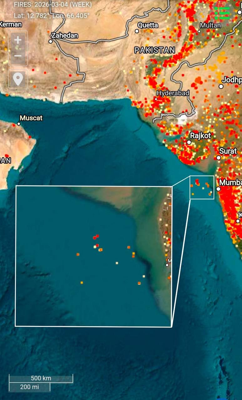
Το Ιράν ισχυρίζεται ότι εξαπέλυσε πυραυλική επίθεση σε ένα αμερικανικό αντιτορπιλικό πλήττοντάς το και προκαλώντας σοβαρές ζημιές.
Δεν έχει επιβεβαιωθεί επίσημα κάτι τέτοιο, ωστόσο από τα δεδομένα από τον θερμικό χάρτη της NASA που παρακολουθεί τις πυρκαγιές φαίνεται πως όντως κάτι συνέβη στα ανοιχτά της Ινδίας.
Το αμερικανικό αντιτορπιλικό βρισκόταν πολύ κοντά στα ινδικά ύδατα, γεγονός που υποδηλώνει ότι η Ινδία επιτρέπει τη χρήση των λιμανιών της για αμερικανικές επιθέσεις στο Ιράν.
“Iran claims that it launched a missile strike on an American destroyer and set it on fire, which was later confirmed by data from NASA’s heat map tracking fires.
The American destroyer was located very close to Indian waters, which suggests that India is allowing the use of its… pic.twitter.com/kARMaWOkQL
— — GEROMAN — time will tell – 👀 — (@GeromanAT) March 4, 2026
Iran claims to have struck an American destroyer and set it on fire, which was subsequently confirmed by NASA’s heat map tracking the fires.
The demoyer was very close to Indian waters, which suggests that India authorises the use of its ports for American attacks on Iran. pic.twitter.com/RnuogqNxIT
— Michael Gnatchenko (@m_gnatchenko) March 4, 2026